A Solo Traveller’s Guide to Tasmania’s Most Remote Trails
Words by Emily Schneider. 15 October, 2025.
Solo hiking in Tasmania carries its own quiet intensity. A mix of risk, solitude, and freedom that’s hard to find anywhere else. It’s remote, vast, and endlessly varied.
Days here unfold between mountain passes and rainforest roads, long stretches where the only movement comes from wallabies in the bush or a wedge-tailed eagle tracing circles overhead. There’s a clarity to Tasmania’s landscapes that strips travel back to its simplest form.
As Australia’s smallest and least populated state, it’s easy to feel uncertain about exploring it alone. But don’t let that hesitation stop you. Travelling solo in Tasmania was one of the most incredible things I’ve ever done, challenging, grounding, and deeply freeing. In this guide, I’ve shared everything I learnt: practical advice for solo hiking, a few of the most rewarding trails, and the small details I wish I’d known before landing in Hobart last February.
Why Tasmania Feels Made for the Solo Traveller
The landscape
Tasmania ticks all the boxes. The landscapes are magical. Nowhere else have I seen such variety packed onto such a small island. You can spend the morning on a white-sand beach fringed by turquoise water, drive an hour inland, and find yourself among alpine peaks, misty forests, or jagged mountain ranges, and most of the time with no one else around. Each day feels like stepping into a new world, and that sense of constant discovery is utterly addictive.
The Trails
What makes Tasmania so suited to solo hiking is how well-organised everything is. The trails are clearly marked and well-maintained, and most trailheads have ranger stations or information boards with up-to-date advice. If I was ever uncertain about a route, whether it looked too exposed or remote to tackle alone, there was always someone to ask, or enough information available to make an informed decision. It feels adventurous, but never reckless.
The People
Hiking isn’t just a pastime in Tasmania; it’s part of the culture. People are warm, down-to-earth, and genuinely supportive of anyone getting out on the trails. I met so many friendly locals and fellow solo hikers who were quick to share tips or even join for a few kilometres. When I climbed Cradle Mountain, for example, I met another solo hiker from the UK on the ascent. We ended up summiting together and walking more than 20 kilometres along part of the Overland Track. Encounters like that capture the spirit of Tasmania’s hiking community perfectly: open, kind, and quietly connected.
The Solitude
Even as someone who’s not particularly “woo-woo,” I can’t overstate how empowering solo hiking is. There’s something grounding and deeply satisfying about navigating tough terrain on your own and realising you’re entirely capable of it. Every hike left me feeling more confident and self-reliant — the kind of quiet strength that stays with you long after you’ve left the trail.
Solo on the Trails: Tasmania’s Most Memorable Hikes
From sea cliffs to alpine plateaus. The trails that defined my time on the island.
I arrived in Tasmania just two days after spontaneously booking a flight from Sydney during my first working holiday in Australia. I had no plan, no return date, and no idea where to start.
By pure chance, I wandered into the Arc’teryx store in Hobart and struck up a conversation with two part-timers. As it turned out, they also happened to be park rangers and mountaineering enthusiasts, and within minutes they’d spread a pile of maps across the counter, circling hidden trails, remote summits, and their favourite corners of the island.
Guided by their suggestions, my own research, and plenty of trial and error, I spent the next few weeks hiking alone across Tasmania.
Here are the routes that stayed with me, all tried and tested solo. From the island’s iconic peaks to the wilder, lesser-known routes.
The Tasman Peninsula
Cape Huay
10.2 kms out and back | 3 hrs | 390m elevation gain | Grade 3
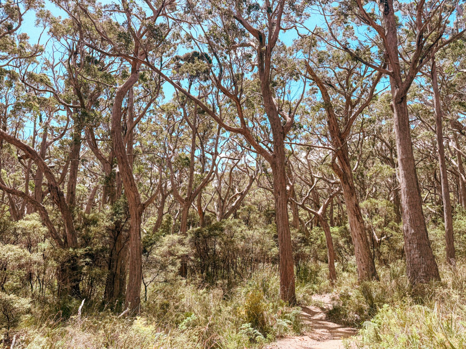
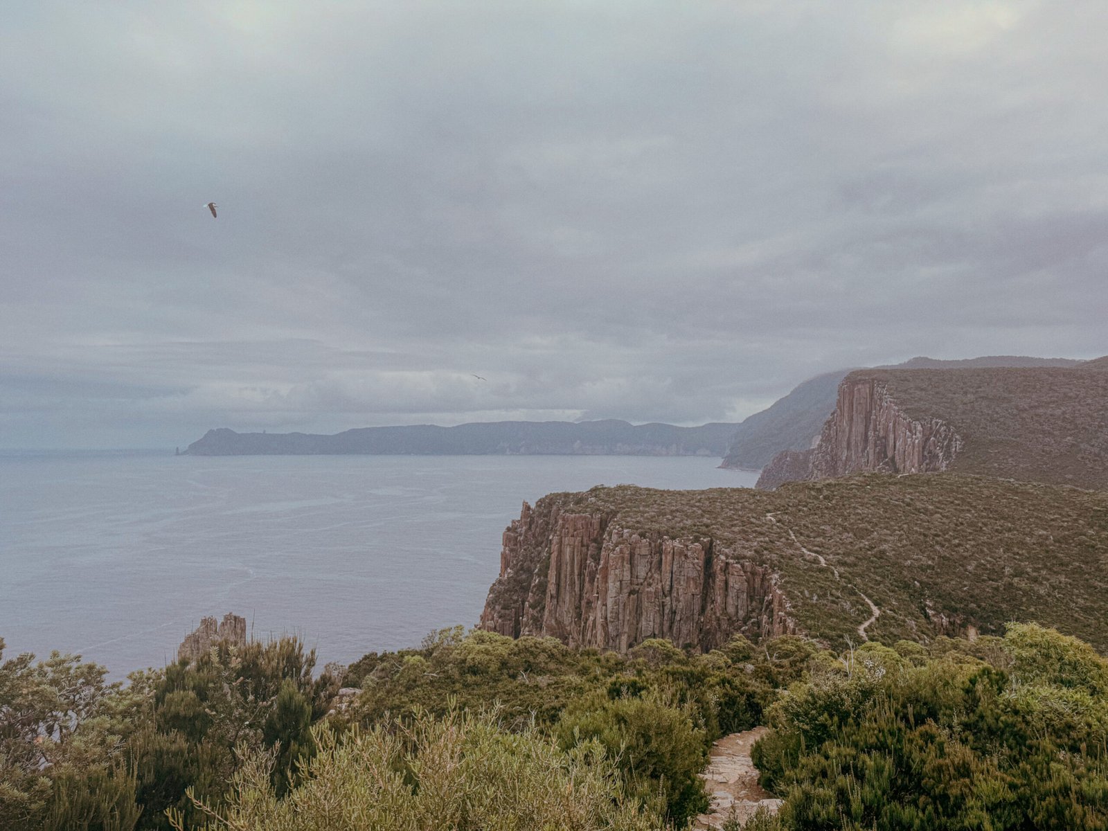
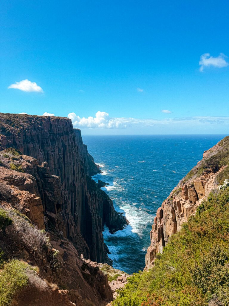
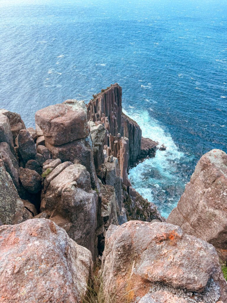
Starting my trip on the Tasman Peninsula set the bar high for the rest of my time in Tasmania. It’s a place of sheer contrasts; ancient cliffs dropping into endless blue, wind cutting through silence, and a landscape that feels suspended between fragility and force. Everything here feels elemental.
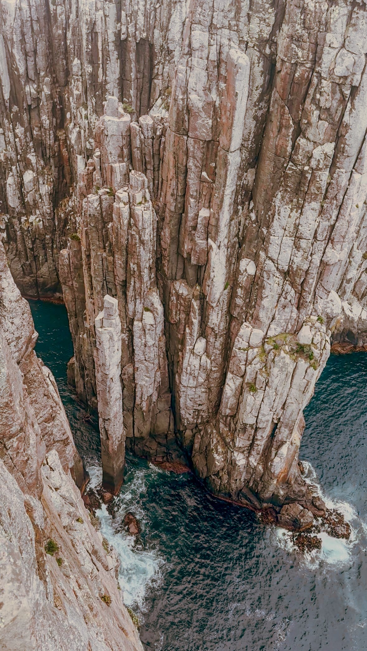
I only had time to hike Cape Hauy, a section of the famous Three Capes Track. Although I would’ve loved to complete the full track, the ancient dolerite sea cliffs of Cape Huay are immense, almost intimidating, being some of the tallest in Australia. It’s a perfect option for solo hikers who want a taste of Tasmania’s wilder coastline without committing to a multi-day trek.
Starting from Fortescue Bay, the path climbs through eucalypt forest and over weathered stone, emerging onto headlands where the landscape suddenly drops away. From the summit, the Candlestick and Totem Pole rise from the water below, sentinels where the Tasman Sea gives way to the vast Southern Ocean.
The path is well-maintained, clearly marked. It’s busy enough that you’ll likely cross paths with other walkers, yet quiet enough to still find moments of complete solitude. I hiked the trail late in the day and had the entire track to myself.
For those with more time (and budget), Cape Hauy forms part of the Three Capes Track. This is a four-day journey that continues deeper along the peninsula, linking Denmans Cove, Cape Pillar, and Fortescue Bay.
Every hiker I met who had completed it spoke about it with the same reverence: beautifully designed eco-huts, careful planning, and that rare balance between comfort and wilderness.
If you’re new to solo multi-day hiking, this is one of the best places to start. The route is well-marked and structured, giving you the freedom to focus on the experience itself rather than the logistics. Just make sure to book ahead as it fills fast.
Cape Raoul
15.3 kms out and back | 6 hrs | 840m elevation gain | Grade 4
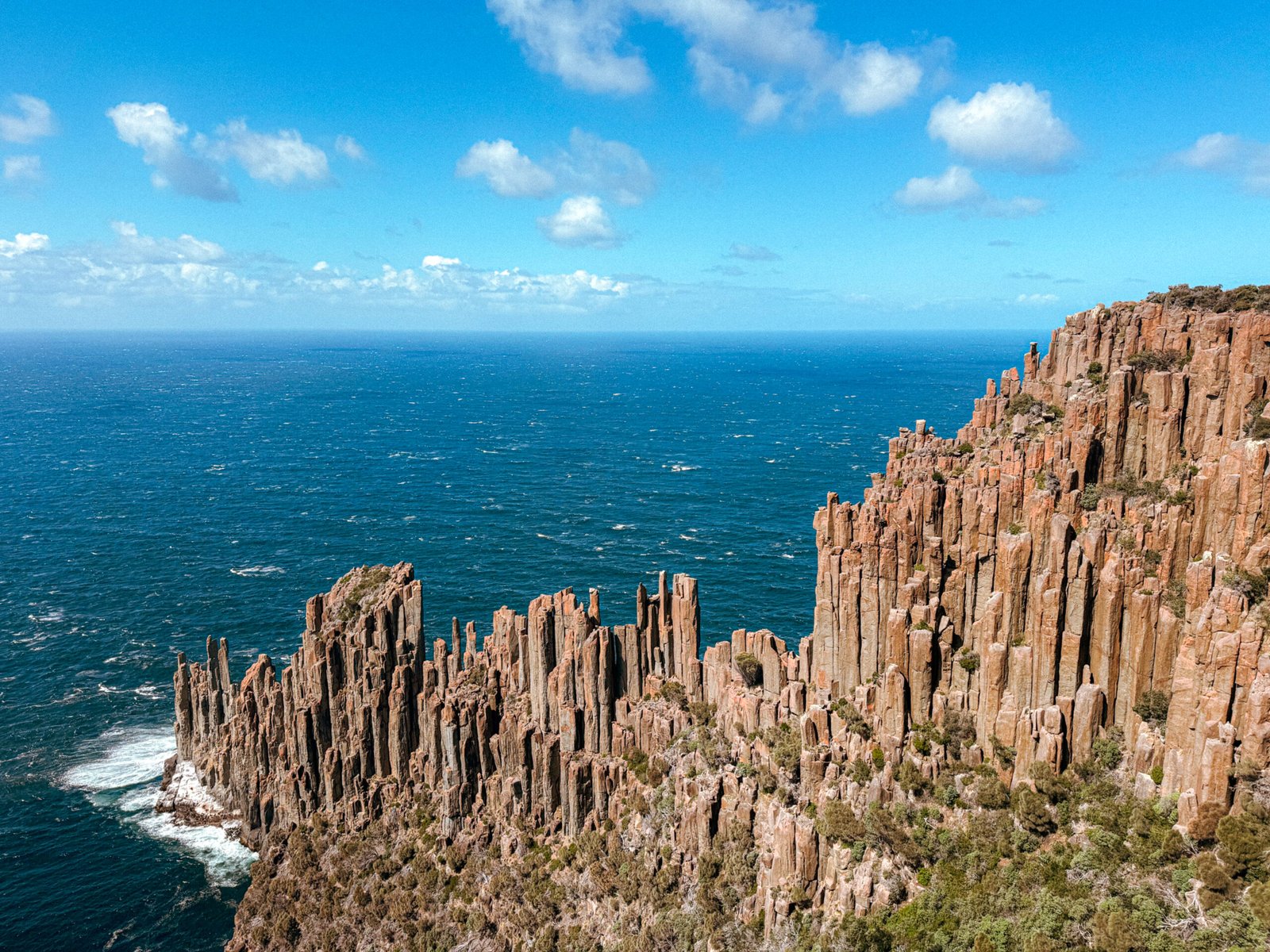
Cape Raoul feels a touch more remote than Cape Huay and the Three Capes Track, and that’s exactly it’s charm. There are no tour buses or big groups here, just the sound of wind and waves echoing off the cliffs.
The only way to the trailhead is to drive yourself, winding through peaceful farmland and eucalyptus forest before reaching Carnarvon Bay. I set off early that morning after a restless night’s sleep in my car, coffee in hand from Lucky Ducks Café in Nubeena and the roads entirely to myself, the kind of slow, solitary start that makes you love solo travel all over again.
The trail begins gently, climbing through cool, fern-filled forest where wallabies graze between wildflowers, before opening out onto the peninsula’s signature dolerite cliffs, sheer rock columns that plunge hundreds of metres into the restless ocean below. Like at Cape Huay, the scale is almost architectural, with the same ancient formations. But here they feel broader, more open, and infinitely more remote.
The climb is steady but rewarding, with views that unfold gradually until you reach the two main lookouts: Cape Raoul and Seal Lookout. Each offers a slightly different perspective of the cliffs and sea below, and if you’re lucky (I was!), you might spot seals basking on the rocks. Pack lunch, take your time, and soak it all in. This is the kind of place that makes you feel wonderfully small.
If you still have energy, there’s a side trip to Shipstern Bluff, home to one of the world’s most legendary surf breaks. Even if you don’t surf, standing there watching those waves detonate against the cliffs is unforgettable, a reminder of just how powerful Tasmania’s coastline can be.
Freycinet National Park
Hazards Beach & Wineglass Bay Loop
11 kms circuit | 4 hrs | 240m elevation gain | Grade 4
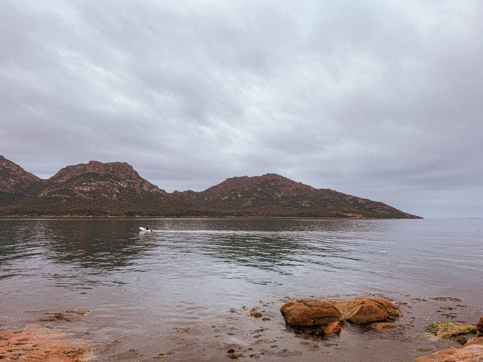
Freycinet might be one of Tasmania’s most photographed destinations, but don’t let that deter you. It’s still remarkably easy to find quiet here, especially if you take on the full Hazards Beach and Wineglass Bay Loop rather than stopping at the lookout like most visitors do.
The trail begins at the Wineglass Bay car park, climbing steadily through smooth granite boulders and dry eucalypt forest before reaching the famous viewpoint. The sight below is as striking as everyone says, a perfect crescent of white sand and turquoise water. One of those landscapes that seems almost too pristine to be real. Standing shoulder to shoulder with other hikers, I couldn’t help wanting to see it without the noise. So I kept walking.
From the lookout, the path descends to the beach itself. The sand is powder-white, the sea impossibly clear, and it’s worth pausing for a swim or a barefoot wander before continuing across the narrow isthmus to Hazards Beach. Here, the crowds fade away. The coastline stretches out in long, golden curves, with the pink granite peaks of The Hazards Range rising behind.
The return track curves inland through quiet she-oak forest, with glimpses of Great Oyster Bay flickering between the trees. It’s a trail that feels constantly in motion, switching from rugged granite to soft sand, and salty air to dry forest. Even in the height of summer, you can still find a stretch of beach to yourself.
The East Coast enjoys milder weather year-round, making this a brilliant winter hike, ideal for those crisp, clear days.
For those craving something longer, the Freycinet Peninsula Circuit, a two-to-three-day 27-kilometre hike, extends the loop around the entire peninsula. It’s a beautiful route weaving through coastal forest, granite peaks, and secluded bays. Water can be scarce, so it’s best tackled in cooler months when creeks are flowing. Campsites at Hazards Beach, Cooks Corner, and Wineglass Bay make for easy overnight stops, and if you’re up for it, there are optional side trips to Mount Freycinet or Mount Graham that reward you with sweeping views over Schouten Island and the peninsula’s southern tip.
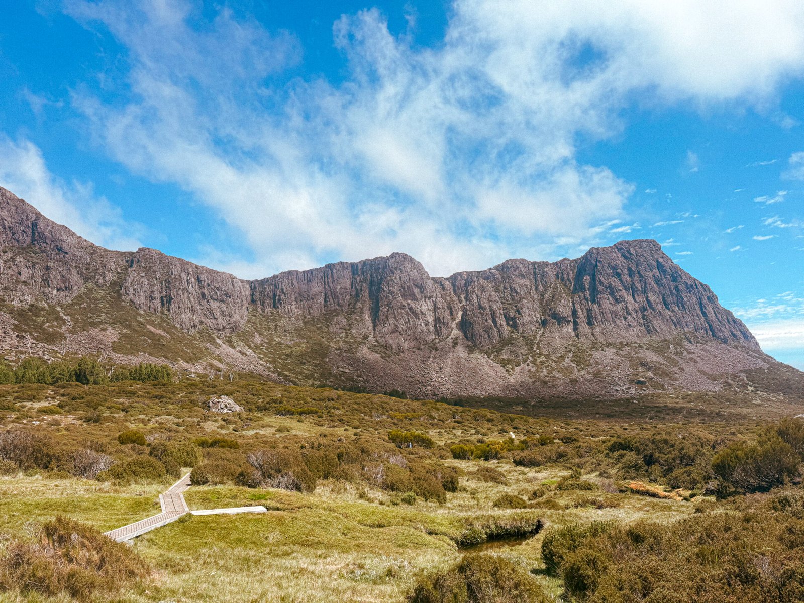
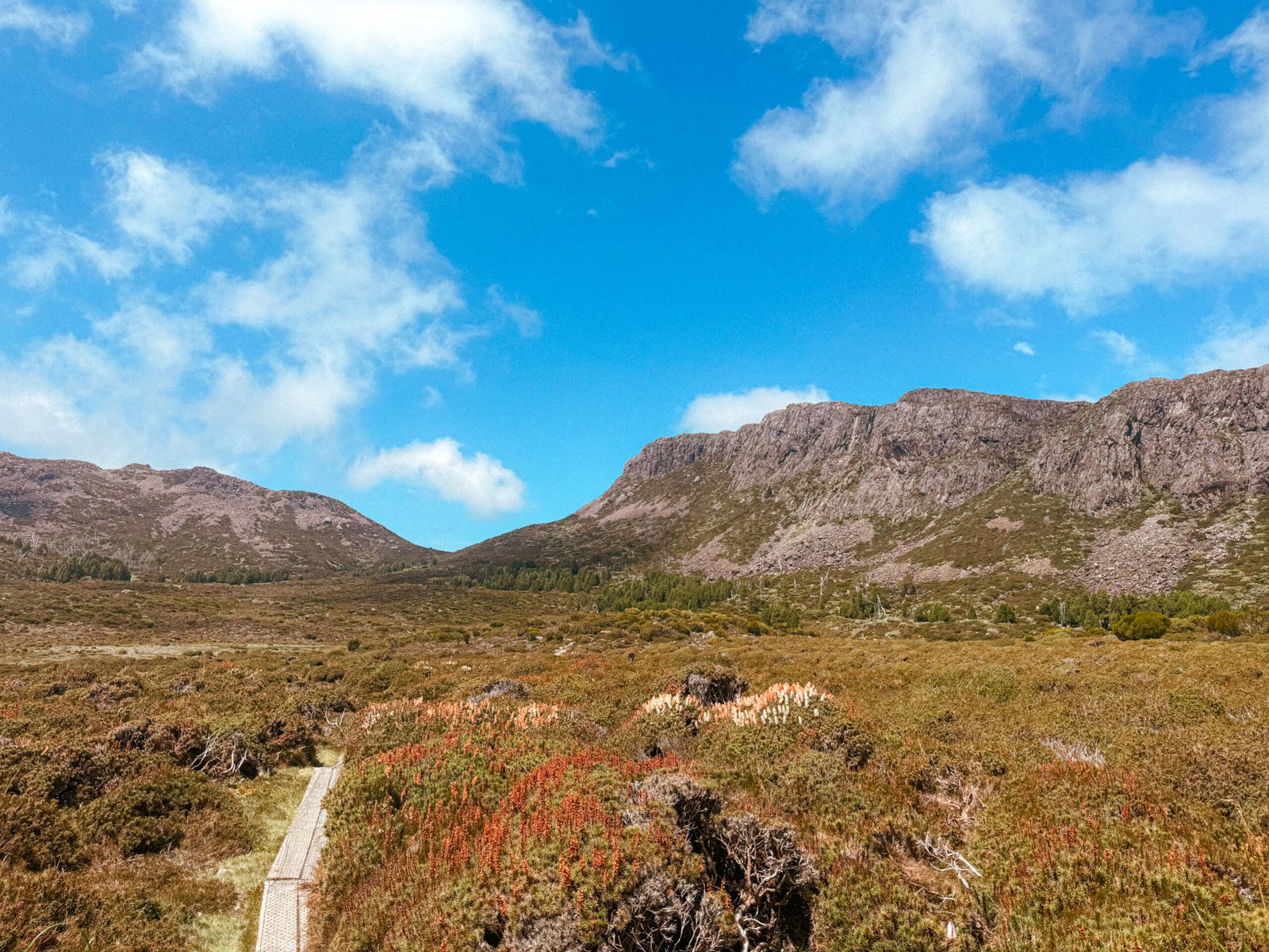
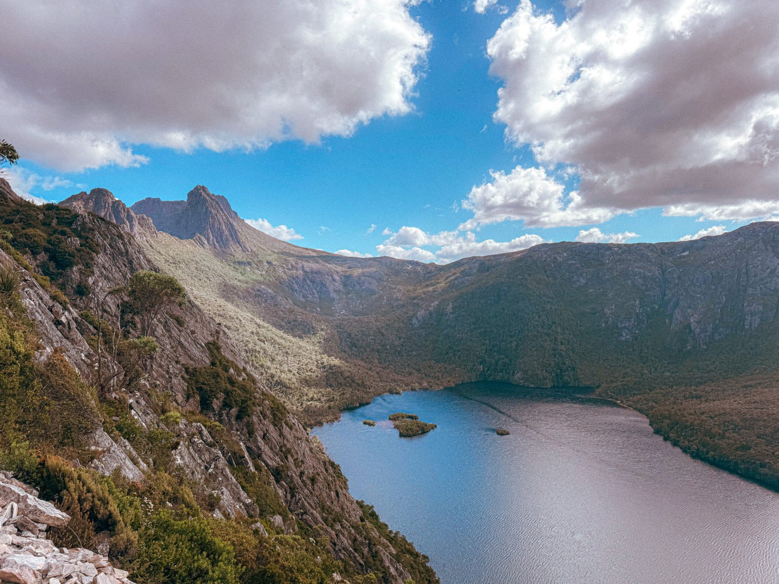
Cradle Mountain National Park
Dove Lake to Lake Lilla loop from Cradle Valley
20 kms circuit | 8 hours | 940m elevation gain | Grade 5
For confident hikers who love a good scramble – exposed and sketchy sections!
If you’ve done even a little research on Tasmania, you’ve almost certainly heard of Cradle Mountain. Every local I met insisted I had to hike it. Naturally, I assumed it would be one of those classic, tourist-friendly climbs: a steady, well-trodden path to the top, something like the human motorway up Snowdon back home in the UK.
I was completely wrong. I massively underestimated this trail, so don’t make the same mistake I did.
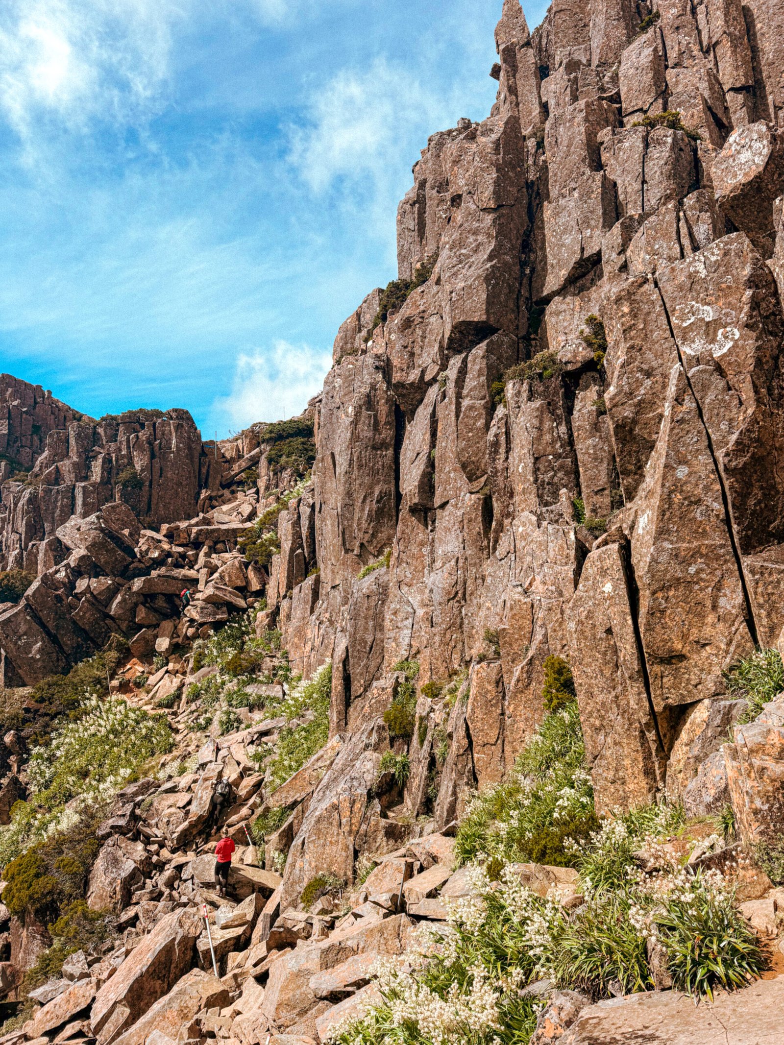
The trail starts gently enough, weaving past Wombat Pool, Lake Lilla, and Marion’s Lookout, with postcard-perfect views of Cradle Mountain in the distance. It’s beautiful and manageable. But once you reach Kitchen Hut, the hike shifts entirely.
The path gives way to boulders, the slope steepens sharply, and you’re suddenly climbing over huge slabs of dolerite rock. The summit sits at 1,545 metres, and while the route is marked by white poles, the scramble is demanding and exposed. Even with a fair bit of alpine experience, tackling it solo was intense.
It’s not that it’s dangerously technical — more that it demands focus, patience, and a cool head. The real risk comes from how underestimated it is. I passed people in sneakers and jeans, some visibly panicked, one man inexplicably wearing a top hat and tailcoat (a mental image that’s hard to forget).
That said, this hike is unforgettable, one of the most exhilarating and rewarding days I had in Tasmania. The summit views stretch endlessly over alpine plateaus and lake country, and there’s such satisfaction in earning them. Even if you skip the final climb, the walk to Marion’s Lookout is a brilliant option on its own. It still captures the spirit of the place: rugged, dramatic, and deeply rewarding.
Start early from Ronny Creek car park if you can. After 8:10 a.m. (8:45 in winter), private vehicles aren’t allowed beyond the Visitor Centre, and hikers must take the shuttle to access the national park. Going early means you can park directly at the trailhead and enjoy a quiet ascent before the crowds arrive. When I reached the top, I had the ridge almost to myself; by the time I was descending, it felt like an entirely different mountain.
The route I took was a 20-kilometre circuit that extends along part of the Overland Track, looping past Benson Peak and returning via Lake Rodway. For an overnight adventure, you can even stay at Scott Kilvert Hut (14.5 km in) beside Lake Rodway, a peaceful spot for a swim and a quiet night under the stars.
A shorter but equally rewarding option is the 12.5-kilometre loop, which follows the north side of Cradle Mountain via Weindorfer’s Tower, Little Horn, and Hanson’s Peak. It’s a popular route for good reason: challenging, scenic, and every bit as memorable.
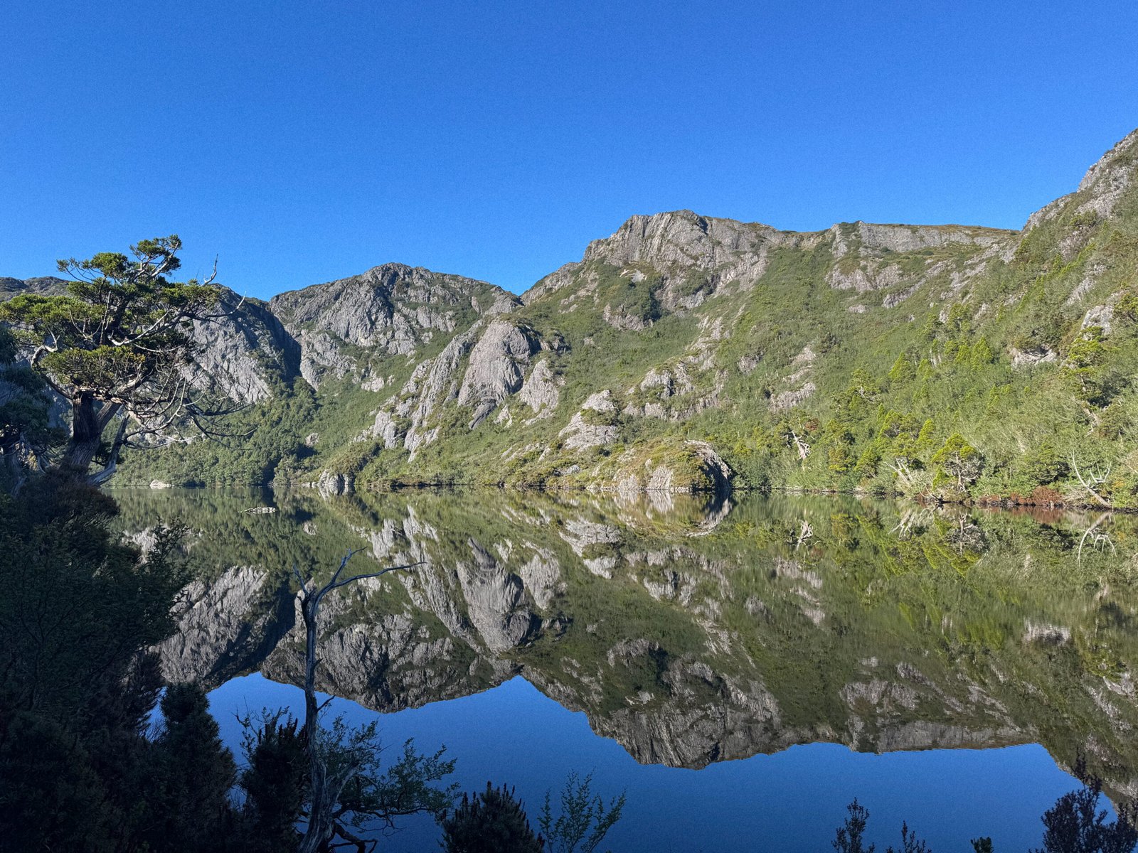
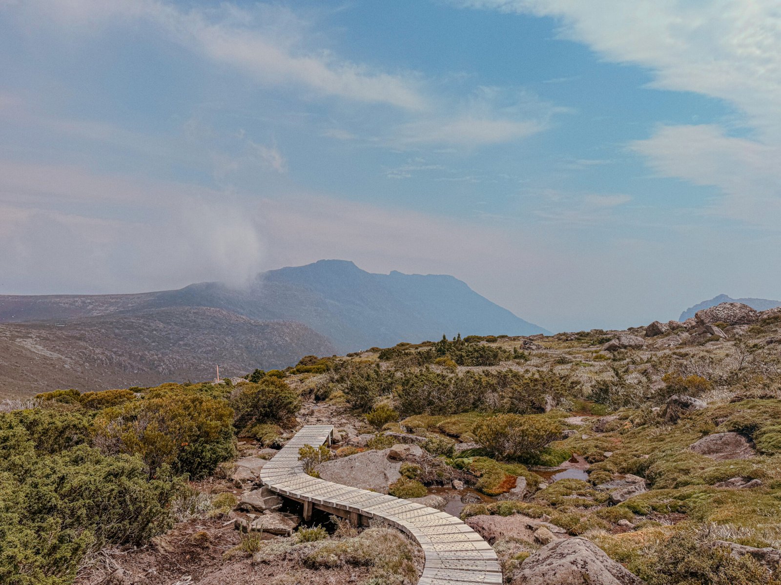
Walls of Jerusalem National Park
Solomon’s Jewels Loop
18.9 kms out and back | 7 hrs | 830m elevation gain | Grade 4
I did this hike the day after Cradle Mountain, and honestly, my legs, body, and mind were hurting. The first three kilometres are a relentless 500-metre climb, and my motivation was fading fast. I nearly turned back before it even began! But I’m so glad I didn’t, as this ended up being my favourite hike in all of Tasmania.
There’s something almost biblical about this landscape, fitting, given the names that mark the trail. This is Tasmania’s high country, carved by glaciers thousands of years ago. Water runs everywhere: in still tarns, trickling creeks, and mirror-like lakes that catch the light between ancient peaks. The colours here are extraordinary with deep green pencil pines, pink scoparia flowers, and silver snow gums gleaming against the alpine air.
After that tough initial climb, the path opens onto the Central Walls plateau, wa world of open meadows and mossy tarns crossed by raised boardwalks. From Herod’s Gate, the view stretches across lakes, dolerite spires, and distant ridgelines. You’ll pass Damascus Gate, Solomon’s Throne, and The Temple, names as striking and timeless as the scenery itself.
If you have the time and gear, turn this into an overnight hike. Camp at Dixon’s Kingdom and take a side trip up Mount Jerusalem for panoramic views of the Central Plateau. You’ll also have the chance to climb Solomon’s Throne or The Temple, both offering sweeping perspectives of the Walls and the valleys below. Loop back to the start via Lake Adelaide to complete the trail as a circuit.
Franklin-Gordon Wild Rivers National Park
Rodway Range Circuit
15 kms circuit | 7 hrs | 570m elevation gain | Grade 5
For experienced hikers hikers comfortable with scrambling, fast-changing weather, and total solitude.
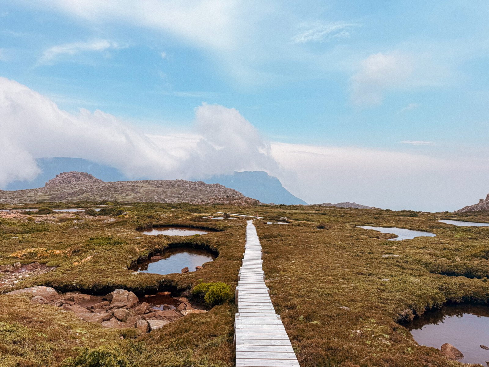
On Tasmania’s west coast, everything feels a little more untamed. The rivers run dark with tannins, the peaks rise sharper and more severe, and even the air feels heavier: damp, moss-scented, and mysterious. The Franklin–Gordon Wild Rivers National Park holds some of the state’s most remote and special alpine trails, and the Rodway Range Circuit captures its essence perfectly. It’s a long, demanding loop that rewards persistence with sweeping views over the Tarn Shelf.
I’ll admit, I was nervous tackling this one solo. Not because of the scrambling or steep ascents, but because I knew I’d likely spend the entire day without seeing another soul. And I did. Seven hours of complete quiet, which was just as beautiful as it was eerie.
The trail begins at Lake Dobson, climbing steadily through snow gum forest before breaking into open alpine country. From there, it weaves through vast dolerite boulder fields known as the Lion’s Den, then along the rugged spine of the Rodway Range with views stretching across Mount Field and into the southwest. After cresting the ridge, the route drops through Newdegate Pass to Lake Newdegate, a string of glacial lakes that glimmer like fragments of glass in the alpine light, before looping back toward the ski fields.
t’s a tough hike, especially when the weather turns. Clouds can roll in within minutes; I watched the red navigation poles vanish one by one into the fog. Between the endless scrambling and the silence, it’s the kind of hike that forces you inward. But the landscape holds you there. It feels ancient, patient and self-contained, a place entirely content in its own stillness.
If you’re camping nearby at Mount Field Campground, don’t miss the glow worms, just a short walk from camp after dark. Turn off your torch, let your eyes adjust, and watch the forest quietly come alive with pinpricks of blue light.
For something gentler, the Tarn Shelf Circuit (12 kms, 6 hrs, Grade 3) follows a lower route past the same chain of lakes, perfect for a slower day when you want the scenery without the full exertion.
Staying Safe on the Trails
It’s easy to get caught up in route planning and chasing summits, but solo hiking in Tasmania also comes with its fair share of risks. The island’s beauty can be deceiving: remote, fast-changing, and sometimes completely unforgiving. It was here that I really learnt what it means to hike alone, to balance independence with caution. These are a few lessons that made all the difference.
Stick to the marked trails
It sounds obvious, but this is rule number one. Tasmania’s wilderness can get disorienting fast, especially in alpine or rainforest sections where the weather can shift in seconds and visibility drops fast. Always follow the markers and resist the urge to ‘cut corners’. I use apps like Komoot or AllTrails for reassurance and download the maps before heading out, so I can still track my location even without reception. I remember once losing visibility completely on the Rodway Range; it was unnerving, but seeing my GPS dot still lined up with the route was a small relief that made all the difference.
Be wildlife aware (but not afraid)
One of the joys of hiking in Tasmania is the wildlife: wombats, wallabies, and if you’re lucky, the occasional Tasmanian devil. You’ll likely see snakes too. I saw more here than I did during my entire year in Australia! But don’t panic – they’re shy, and bites are extremely rare. Still, it helps to be prepared: wear long trousers and sturdy boots, make noise through long grass, and carry a snake bandage in your first-aid kit. (Look up the “pressure immobilisation technique”, there are great short videos online.)
Prepare for unpredictable weather
Tasmania’s weather is famously changeable. I’ve started hikes under bright blue skies and ended them in sideways rain and fog thick enough to hide the trail entirely. Always carry extra layers, waterproofs, and a rain cover for your bag if you have one, even if it looks like summer. Before setting out, check updates from the Tasmanian Parks & Wildlife Service or apps like BOM Weather and Windy for the latest local forecasts.
Tell someone your plan
This one’s non-negotiable. Always let someone know which trail you’re hiking, your expected start and finish times, and when they should expect to hear from you. Better yet, check in with a ranger before you go; they can update you on track conditions or closures, and it’s reassuring to know someone’s aware of your route.
Trust your instincts
If something doesn’t feel right, the weather, your energy, or the trail itself, listen to that feeling. There’s no shame in turning back. One of the best things about solo hiking is learning when to push forward and when to call it a day. The trail will always be there when you’re ready to try again.
Reflections
Tasmania has a way of getting under your skin. It’s unpredictable, untamed, and so quietly beautiful that even when it unsettles you, you can’t help but fall for it. Hiking here alone taught me more than how to navigate a map or pack a bag; it taught me resilience, patience, and how to feel at home in uncertainty.
If you’re considering solo hiking here, especially as a woman, know that it’s absolutely possible and worth every challenge. Be smart, be prepared, respect the wilderness, and don’t let hesitation win. Tasmania’s trails have a way of reminding you just how capable you really are.